
The Case for Going Private: Christchurch to Mount Cook on Your Own Terms
Let's be direct about something most tourism websites won't tell you: there is no regular public transport to Aoraki Mount Cook National Park. No train line reaches the Mackenzie Basin. The InterCity coach network that serves much of the South Island does not extend to Mount Cook Village. The handful of shuttle services that do operate run fixed schedules, fixed stops, and fixed compromises — and they tend to fill with whoever else happens to be going that direction on that particular day.
For a journey this significant, covering 330 kilometres through some of New Zealand's most consequential landscapes, the private transfer isn't a luxury upgrade. It's the only arrangement that makes genuine sense. You control the departure time. You stop where the light is extraordinary. You arrive at the Hermitage having actually absorbed the journey, not endured it.
This is what the Christchurch to Mount Cook private transfer with Legacy EPT looks like in practice — the route, the logistics, the vehicles, and what awaits at the end of the road.
Leaving Christchurch: South on State Highway 1
Most guests depart Christchurch International Airport or a central city hotel. Legacy EPT's uniformed driver will meet you in the arrivals hall or at your accommodation — your luggage handled, the vehicle cooled or warmed to the season, departure timed around your actual arrival, not a printed timetable. Flight monitoring is standard; if your connection from Auckland runs late, the driver already knows.
The first leg is State Highway 1 south, running through the flat eastern margins of the Canterbury Plains. This stretch — passing Rolleston, through Rakaia and Ashburton — is functional rather than spectacular, though the wide-open Canterbury sky has a particular quality worth watching. The plains here were built by millennia of glacial outwash from the Southern Alps, and you're crossing that outwash now, the mountains a blue-grey smudge to the west. Ashburton sits roughly 85 kilometres from Christchurch and marks a useful point of orientation: you're a quarter of the way to Mount Cook, and the serious scenery is still to come.
Near Washdyke, just north of Timaru, the route turns inland. This is where the journey changes character.
Into the Mackenzie: Burkes Pass and the Basin Beyond
From Washdyke, State Highway 8 takes you west through Temuka and Pleasant Point before beginning its climb toward Burkes Pass — the 670-metre threshold between coastal Canterbury and the high-country interior known as the Mackenzie Basin. The pass itself is modest in elevation, but what it reveals on the far side is not.
The Mackenzie is a tussock-covered intermontane basin roughly 100 kilometres long and up to 40 kilometres wide, ringed by the foothills of the Southern Alps to the west and the Two Thumb Range to the east. The scale disorients pleasantly. The light here behaves differently than it does on the coast — harder, clearer, with a quality that painters and photographers have been trying to account for since Europeans first arrived. Merino sheep graze properties that run to tens of thousands of hectares. Lupins in shades of purple and pink colonise the roadsides from November through January, a technically invasive species that the South Island has decided, somewhat resignedly, to find beautiful.
Lake Tekapo appears first, approximately 225 kilometres from Christchurch. Allow time here.
Lake Tekapo: The Church, the Colour, the Dark Sky
The colour of Lake Tekapo is not something that photographs adequately prepare you for. The water is a milky turquoise produced by glacial flour — fine particles of rock ground by the Godley and Cass glaciers and suspended in the meltwater — and it shifts from pale mint to deep teal depending on cloud cover and time of day. The lake sits at 710 metres above sea level and covers 83 square kilometres.
The Church of the Good Shepherd, built in 1935 from local schist stone and sitting directly on the lake's edge, is worth the stop not because it appears on every postcard of the South Island but because standing inside it, looking through the east-facing window at the lake and the Ben Ohau Range beyond, you understand exactly why someone chose to build a church here and frame it precisely this way. It takes less than ten minutes to walk from the car park to the church and back. Most people take considerably longer.
Tekapo township offers coffee, fuel, and a legitimate reason to pause. The Mount John University Observatory sits on a hill above the town and forms part of the Aoraki Mackenzie International Dark Sky Reserve — at 4,300 square kilometres, one of the largest such reserves in the world. If your itinerary includes a night at Tekapo, the stargazing through Earth & Sky's operated telescope sessions is exceptional. If you're passing through en route to Mount Cook, note that the same reserve status applies to the national park itself, and the night sky from the Hermitage terrace, assuming clear conditions, requires no additional commentary.
Lake Pukaki and the Last 55 Kilometres
From Tekapo, State Highway 8 continues southwest for approximately 45 kilometres to the junction at Lake Pukaki's southern end. This is where the journey earns whatever superlative you were holding in reserve.
Lake Pukaki is larger than Tekapo — 169 square kilometres, at 520 metres elevation — and its colour is more intense, a deep glacial blue that carries a faint green cast in direct sunlight. The lake was raised 8 metres as part of the Upper Waitaki hydroelectric scheme in the 1970s, which dramatically expanded its surface area. At the far end of the lake, when conditions cooperate, Aoraki Mount Cook rises to 3,724 metres — New Zealand's highest point — reflected in the water with the kind of clean symmetry that makes you question whether what you're looking at is real or a backdrop.
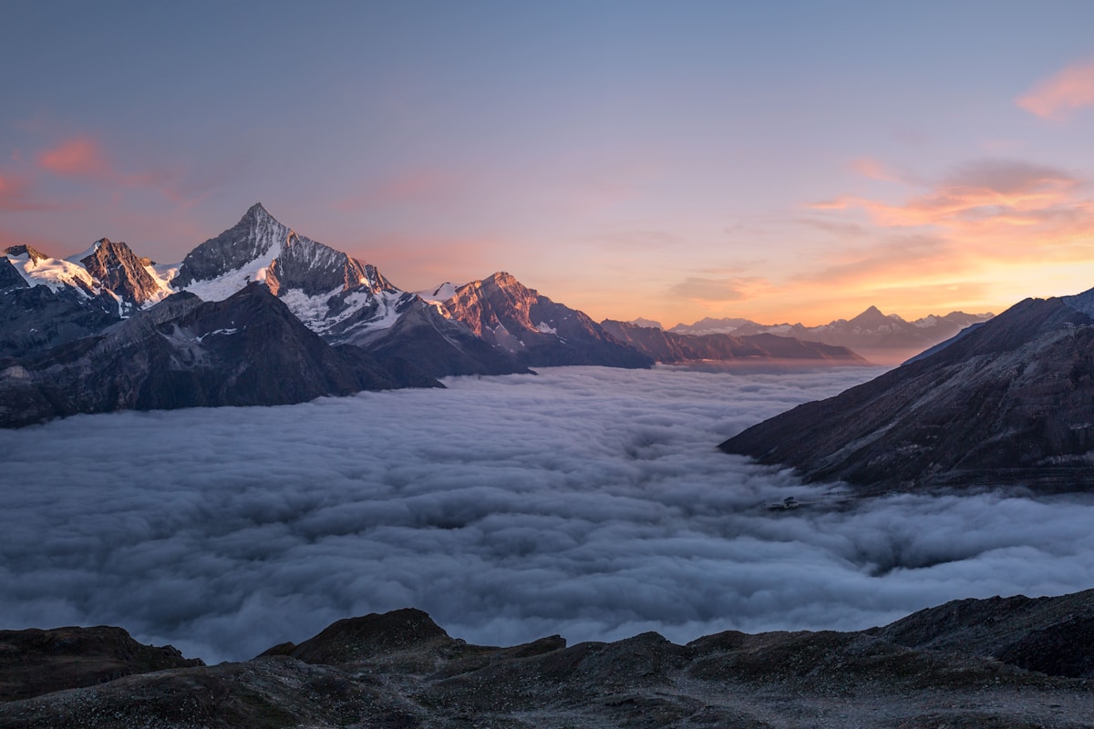
State Highway 80 branches north from the SH8 junction and runs for 55 kilometres along the western shore of Lake Pukaki, terminating at Mount Cook Village. There is no road beyond the village. The highway ends where the national park begins in earnest, and Aoraki fills the windscreen with increasing authority as you cover those final kilometres. Glacially fed streams cross under the road. The Ben Ohau Range rises to the east. Tasman Valley opens to the left. The driver who has made this approach dozens of times knows to say nothing.
Total driving time from Christchurch to Mount Cook is approximately four hours without stops, or five to five and a half hours with a proper pause at Lake Tekapo and a viewpoint stop at Lake Pukaki. Legacy EPT departures are timed to put you at the Hermitage in the late afternoon, when the light on Aoraki's west face is at its most considered.
The Fleet: Matching the Vehicle to the Journey
For couples or two-guest travel, the Mercedes-Benz E-Class is the default choice — a current-generation executive saloon with the ride quality and cabin refinement appropriate to 330 kilometres of mixed highway and alpine approach road. Long-distance comfort on New Zealand roads rewards a properly specced suspension setup, and the E-Class delivers it. Leather seating, climate control, generous boot space for ski bags or hiking gear if you're arriving in season.
For families, small groups, or guests with substantial luggage — photography equipment, golf bags, ski gear in winter — the Mercedes-Benz V-Class is the more practical choice. Seating for up to seven passengers, generous luggage capacity in the rear, and a high seating position that gives every passenger a proper view of the Mackenzie Basin and the lake approaches. For groups of eight to twelve, a Sprinter provides the same standards with greater capacity. The Legacy fleet is detailed in full on their website, including vehicle specifications and appropriate capacity guidance for different journey profiles.
All vehicles are current-generation. Drivers are uniformed, hold professional passenger endorsements, and carry the kind of localised knowledge — where to stop for the best Pukaki reflection shot, which side of the road to watch near the Tasman River bridge — that no navigation app replicates. Legacy EPT's services extend across both islands, and the Christchurch-based team handles South Island transfers including Queenstown, Dunedin, Kaikōura, and the West Coast as well as this route.
What to Do at Mount Cook: Three Days, Properly Used
Mount Cook Village is small — a cluster of accommodation, a visitor centre, and the landmark Hermitage Hotel, which has occupied the same site since 1884 in various iterations and offers 211 rooms, multiple dining options, and a dedicated Aoraki Room with floor-to-ceiling windows oriented directly at the mountain. Most guests who arrive intending to spend one night find themselves rebooking for a second.
The Hooker Valley Track is the defining walk. Starting from a car park near White Horse Hill campground, the track covers 10 kilometres return with minimal elevation gain, crossing three swing bridges over the Hooker River before terminating at Hooker Lake, where small icebergs calved from the Hooker Glacier float in water of a particular opaque grey-blue. The walk takes between two and a half and three hours at a moderate pace. It requires no technical equipment in summer, though the weather in the Mackenzie can change faster than coastal visitors typically expect — a down jacket and waterproof shell are not optional.
Glacier flights operate from Glentanner aerodrome, approximately 20 kilometres south of the village on the Pukaki lakeshore. Operators including Mount Cook Ski Planes and Helicopters run fixed-wing and helicopter options over the Tasman Glacier — at 27 kilometres in length, the longest glacier in New Zealand — with the longer itineraries including a snow landing on the neve at altitude. Weather cancellations are a real possibility; build a buffer day into your itinerary if the flight is a priority.
The national park covers 70,696 hectares and includes 19 peaks above 3,000 metres. In winter, guided mountaineering and heli-skiing are available through specialist operators. In summer, the alpine flora on the Hooker Valley floor — including Mount Cook buttercup, Ranunculus lyallii, technically the world's largest buttercup — is in flower from November through January.
The Return Journey and the Queenstown Combination
Return transfers to Christchurch operate on the same schedule and standard as the inbound journey. For guests concluding their South Island itinerary with Mount Cook rather than beginning it, a morning departure from the Hermitage puts you back in Christchurch in time for afternoon or evening international connections.
The more popular routing for international visitors is the Christchurch-to-Mount-Cook-to-Queenstown sequence, covering the full sweep of the South Island's alpine interior over two or three days. From Mount Cook Village, Queenstown is approximately 260 kilometres via State Highway 8 south through Twizel and Omarama, then west over the Lindis Pass — a 971-metre crossing through tussock terrain that qualifies as one of the more scenic inland routes in New Zealand — before dropping into the Clutha River system and approaching Queenstown from the north via Cromwell and the Crown Range road or via the Kawarau Gorge. Legacy EPT operates across all these locations, and a multi-day itinerary combining Christchurch, Mount Cook, and Queenstown can be structured as a single booking with consistent vehicle and driver continuity.
For guests with schedules that allow it, an overnight at Omarama — the gliding capital of New Zealand, sitting at the junction of three major glacial valleys — breaks the Mount Cook to Queenstown leg into two comfortable drives and adds a dimension to the journey that pure transit doesn't accommodate. Request a quote that reflects your specific routing, travel dates, and group composition, and the Legacy team will configure the most efficient and considered itinerary for the time you have available.
The ground between Christchurch and Aoraki covers more compressed geological drama than most countries contain in their entirety. The vehicle you choose to cross it in, and the arrangement under which you travel, is not an incidental decision. Contact the Legacy EPT team to discuss what your journey should look like.