
The Road North: Understanding the Queenstown to Mount Cook Transfer
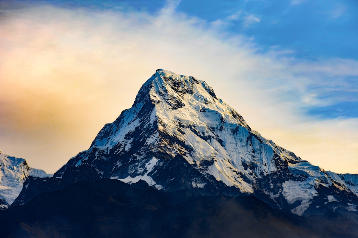
There are drives in New Zealand that reward patience, and there are drives that demand attention from the first kilometre. The 260-kilometre private transfer from Queenstown to Aoraki Mount Cook National Park belongs firmly in the second category. This is not a motorway run. It is a sustained passage through four distinct landscapes — the schist-rock gorges of Central Otago, the tawny high country of the Lindis, the wide geometric calm of the Mackenzie Basin, and finally the narrow glacial corridor of State Highway 80 where, on a clear day, the summit of Aoraki appears so large and so close that it registers more as a presence than a view.
The journey takes between three and a half to four hours under normal conditions, depending on the pace of travel and whether you stop. That is honest time on honest roads — SH6 north from Queenstown, the transition to SH8 through Cromwell and the fruit orchards of the Cromwell Gorge, then the long arc through Omarama and Twizel before SH80 delivers you to Mount Cook Village at 760 metres above sea level. Every segment of this route has a different character, and the intelligence of a well-planned transfer is knowing where to slow down, where to explain, and where simply to leave the scenery alone.
Queenstown to Cromwell: The First Hour Through Central Otago
Legacy EPT collects passengers from their Queenstown hotel or from Queenstown Airport — IATA code ZQN — with real-time flight monitoring ensuring that delays do not leave travellers standing on the kerb. Luggage goes into the vehicle. Introductions are brief. The drive begins.
Leaving Queenstown on SH6, the road runs northeast along the Kawarau River corridor, through the Gibbston Valley wine sub-region. The Kawarau Gorge is compressed and dramatic, with the river running fast and green below the road and the schist bluffs rising vertically on both sides. This stretch, roughly 40 kilometres from Queenstown to Cromwell, takes approximately 35 minutes and sets the geological tone for what follows: this is ancient landscape, worn and coloured by time, the rock stained ochre and rust from millennia of weathering.
Cromwell itself sits at the confluence of the Clutha and Kawarau Rivers — though much of old Cromwell now lies beneath Lake Dunstan, the reservoir created when the Clyde Dam was completed in 1992. The town's stone precinct, Old Cromwell Town, was partially relocated and preserved above the waterline. More practically for travellers heading north, Cromwell marks the point where the journey opens up. The orchards begin here — cherries, apricots, peaches, nectarines grown in the dry continental climate that makes Central Otago one of the most productive stone fruit regions in the Southern Hemisphere. In midsummer, the roadside stalls along SH8 between Cromwell and Tarras are a legitimate reason to reduce speed.
The Lindis Pass: Elevation, Space, and the High Country Transition
North of Tarras, the road begins its ascent toward the Lindis Pass, the 670-metre saddle that separates Central Otago from the Mackenzie Country. This is SH8 in its most remote form: a well-maintained two-lane sealed road that winds through tussock-covered hills with almost no human infrastructure visible in any direction. The Lindis is not technically challenging driving, but it requires full engagement — the combination of elevation change, occasional ice in winter, and open-range livestock on the road demands the kind of relaxed competence that comes from knowing the road rather than navigating it for the first time.
The summit itself is unremarkable in the way that open country often is — it does not announce itself. What matters is the descent on the northern side, where the Mackenzie Basin begins to unfold below. The scale is genuinely disorienting for travellers arriving from the compressed valleys of Queenstown. The Mackenzie is approximately 100 kilometres long and 40 kilometres wide, a glacially carved trough floored with tussock grassland and ringed by the Southern Alps to the west and the Two Thumb Range to the east. On a clear day, from the upper reaches of the Lindis descent, the view extends to mountains you cannot yet name.
Winter travel over the Lindis Pass — broadly June through August — requires appropriate consideration. NZ Transport Agency road condition updates are standard pre-departure practice for Legacy EPT drivers operating this route. The pass can be affected by snow and ice, and while it is rarely closed, reduced visibility and surface frost require adjusted speed and heightened attention. Chains are not typically required for modern all-season tyres in normal winter conditions, but this is a route where local knowledge matters more than GPS confidence.
The Mackenzie Basin: Omarama, Twizel, and the Optional Salmon Stop
The descent from the Lindis brings you into Omarama — a small service town known, among those who pay attention to such things, as one of the premier glider and soaring locations in the world. The terrain here channels thermal activity with unusual reliability, and on any given summer afternoon the sky above Omarama is threaded with gliders riding columns of warm air above the surrounding ridgelines. It is worth noting, not stopping for, unless your schedule permits.
Continuing north on SH8, the road skirts the eastern shore of Lake Ohau — a 23-kilometre glacially formed lake at 520 metres elevation, flanked by the Ohau Range to the west. The lake's colour shifts with the light and the season, ranging from flat grey under cloud to an improbable aquamarine under summer sun. The Ohau Canal, which connects the lake to the Pukaki hydro system, crosses beneath the highway roughly 10 kilometres north of the lake's outflow.
Twizel is the functional hub of the Mackenzie Basin — a planned township established in 1968 to house workers building the Upper Waitaki hydroelectric scheme, and subsequently preserved and populated after the scheme's completion in the early 1980s. It is a useful stop for fuel, provisions, and — for those who want it — the salmon farm.
The Salmon Farm at Twizel, operated from the glacially cold, clear water of the Pukaki Canal, raises Chinook salmon using the same high-altitude runoff that feeds the lakes. The visitor facility allows travellers to feed the fish and purchase fresh and smoked salmon to take away. It is a 15-minute stop, at most, and it works best for travellers who are not on a rigid schedule. The smoking facility on-site produces a product that is difficult to replicate elsewhere in New Zealand — cold-smoked using local hardwood, with a texture and flavour that reflects the purity of the water source. Legacy EPT drivers familiar with this route can advise on timing and whether the stop makes sense within your arrival window at Mount Cook.
The Final Approach: SH80 and the Arrival at Aoraki
North of Twizel, SH8 passes Lake Pukaki — and this is where the drive changes register entirely. Lake Pukaki is fed directly by glacial meltwater from the Tasman Glacier and carries a suspended fine mineral flour that refracts light and renders the water an almost implausible blue-green. The lake is 8 kilometres wide and 17 kilometres long, and when the air is clear, Aoraki Mount Cook — at 3,724 metres, the highest point in Australasia — is visible from the southern end of the lake, framed by the terminal moraine that forms the lake's southern boundary.
The turn onto SH80 at the southern end of Lake Pukaki is the transition from transit to destination. The highway runs along the lake's western shore for approximately 55 kilometres to Mount Cook Village — a sealed, single-lane-in-places road that follows the water's edge with the Sealy Range rising immediately to the left and the lake falling away to the right. There are no towns, no intersections, no infrastructure beyond the occasional Department of Conservation sign. The road ends where the valley ends: at Mount Cook Village, established at the foot of the Hooker Glacier terminal moraine, with Aoraki filling the head of the valley at a scale that makes perspective temporarily unreliable.
The total distance from the SH8/SH80 junction to Mount Cook Village is 55 kilometres. Allow 45 to 50 minutes from this point. The road surface is good — regularly maintained, well-marked — but the route demands attentiveness given its narrowness and the volume of campervans and tourist vehicles in the summer season, which runs roughly from late October through April.
What Travellers Do at Mount Cook: The Tracks, the Glacier, and the Hermitage
The Hooker Valley Track is the walk that most visitors at Mount Cook do, and it is that rare thing in popular tourism: a walk that fully justifies its reputation. The track begins near the White Horse Hill campsite, approximately two kilometres from Mount Cook Village, and covers 10 kilometres return with around 150 metres of elevation gain. The route crosses three swing bridges over the Hooker River and ends at a terminal lake at the foot of the Hooker Glacier, where icebergs — small, brilliant blue, calved from the glacier's snout — float in water so cold it is difficult to hold your hand in for more than a few seconds. On a clear day, the summit of Aoraki is visible for the full length of the valley. Allow two and a half to three hours return at a comfortable pace.
For those whose time at Mount Cook extends to more than a day — or who simply want to cover more altitude than their legs can manage — helicopter glacier landings are available through several operators based at the Glentanner Park aerodrome, approximately 20 kilometres south of the village on SH80. These flights typically land on the Tasman Glacier, the longest glacier in Australasia at approximately 23 kilometres, and include time on the ice surface. The experience of standing on a living glacier, watching the seracs and crevasse systems at close range, is one of those things New Zealand does particularly well and that no photograph adequately conveys.
The Tasman Glacier Viewpoint — accessible via a short, steep track from the Blue Lakes carpark near the national park boundary — provides an elevated perspective on the glacier's terminal lake, which has been rapidly expanding since the 1970s as the glacier retreats. The scale of the retreat is visible in the exposed moraine walls, and the terminal icebergs, much larger than those at the Hooker Lake, drift in water coloured the same mineral blue as Pukaki.
The Hermitage Hotel anchors Mount Cook Village and has done so in various forms since 1884. The current building is utilitarian from the exterior but positioned with an almost unfair directness — the main wing faces Aoraki at a distance of roughly 18 kilometres, close enough to read the detail of the rock faces and snowfields without optical assistance. The Sir Edmund Hillary Alpine Centre within the hotel combines a museum of New Zealand mountaineering history with a planetarium that offers a useful orientation to the Southern Alps and their glaciology. Dinner at The Hermitage tends to be the social centre of the village in the evenings, and the wine list draws appropriately from the Central Otago and Marlborough regions you have recently driven through.
How Legacy EPT Operates This Transfer
The Queenstown to Mount Cook transfer is one of the routes where the choice between self-driving and a private vehicle most clearly resolves in favour of the latter. The logic is not about road difficulty — SH6, SH8, and SH80 are all manageable roads for a competent driver — but about attention. A driver who knows that the tussock on the Lindis descent turns bronze in late afternoon light, who knows that the Pukaki viewpoint layby on the western side of the highway gives the cleanest angle on the mountain, who knows to mention the Tasman Glacier drainage channel as you cross it on SH80 — that driver converts a transfer into a briefing. By the time you reach Mount Cook Village, you understand what you are looking at.
Legacy EPT operates the Legacy fleet of current-generation Mercedes-Benz vehicles for this transfer: the S-Class for single travellers or couples travelling at VIP standard, the E-Class for executive transfers, the V-Class for groups up to seven, and the Sprinter for groups up to twelve. Luggage is managed by the driver at both ends. Refreshments are provided en route. The uniformed driver meets you at your Queenstown hotel or at the airport arrivals hall, with flight monitoring ensuring the schedule adjusts to your actual arrival rather than your scheduled one.
Because Legacy EPT is a privately owned, New Zealand-operated company — not a franchise, not an aggregator, not a booking platform intermediary — the person you contact when you request a quote is the same organisation that sends the driver. There is no subcontracting layer, no margin transfer, no diffusion of accountability. This matters on a transfer of this length and remoteness more than it might in a city run.
The Queenstown to Mount Cook transfer is also most commonly booked as one leg of a three-point itinerary: Queenstown to Mount Cook, then Mount Cook to Christchurch — a further 330 kilometres via SH8 east through Tekapo and the Canterbury Plains. Legacy EPT covers both legs, and the combination of these two transfers represents one of the most coherent fly-drive itineraries available in the South Island. Details on both routes, and on Legacy EPT's broader South Island coverage, are available through our locations page or directly through contact our team. A full summary of transfer services is available at our services page.